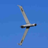
 Boeing‘s Insitu subsidiary and Esri have collaborated to conduct test flights of an unmanned aerial vehicle technology that was equipped with geographic information system designed to aid firefighting missions.
The flights took place at a Federal Aviation Administration test range in Warm Springs, Oregon, and sought to demonstrate the potential of ScanEagle UAS to help firefighters and fire responders, Insitu said Tuesday.
Insitu also deployed INEXA professional aerial remote sensing teams along with its ScanEagle platform to support firefighters, the Oregon Department of Forestry and other government agencies in the state.
ScanEagle also offered near real-time data to boost the situational awareness and safety of firefighters and first responders in support of emergency response missions.


