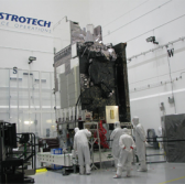
Harris has produced the second imager technology to help the National Oceanic and Atmospheric Administration monitor weather and environmental conditions from space.
The company said Tuesday it built the Advanced Baseline Imager to increase the spectral coverage and processing speed of NOAA’s next Geostationary Operational Environmental Satellite.
GOES-S is the second of the agency’s four geostationary weather satellites and scheduled to launch from Cape Canaveral, Florida, on March 1.
Harris also built an enterprise ground system to manage the entire GOES series.
The GOES-R satellite that launched in November 2016 also employs the company’s imager technology that helped track hurricanes over the Caribbean and the Gulf of Mexico.
Harris will also supply ABIs for the GOES-T and GOES-U satellites.


