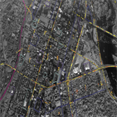
 BAE Systems has updated its suite of geospatial analysis software to include movement intelligence tools designed to help analysts identify threats among people, vehicles and other objects.
The company said Monday its Geospatial eXploitation Products‘ new MOVINT functions that work to interpret movement and activity from motion sensors such as video and radar.
Dana Poirier, general manager of BAE’s GXP group, said the company developed its MOVINT tools to help customers monitor multiple feeds across numerous regions.
The technology works to provide situational awareness, intelligence and insight for missions such as border security, counterterrorism, drug interdiction and infrastructure protection, the company noted.
GXP products are built to help users discover, exploit and disseminate geospatial intelligence in support of military, security, incident response, commercial and international operations.


