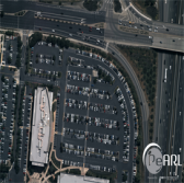
 OGSystems has rolled out its updated three-dimensional aerial imaging system and sensor-based processing system for 2D and 3D images.
The PeARL aerial imaging platform is equipped with a modern sensor that works to provide approximately 1.6 inches of ground sample distance at a 10,000 feet above ground level with about 2,000-yard configurable swath width, OGSystems said Thursday.
The company updated the imaging system to address sensor size, weight and power requirements of customers.
OGSystems’ PeARL Flash processing tool is designed to help customers process aerial imagery and view results over a secure internet connection.
Flash works to create user-defined, on-demand 3D products that include digital terrain models, digital surface models and true color encoded point clouds from 2D imagery.
Hector Cuevas, an OGSystems associate partner, said the PeARL products to integrate multi-sensor content into a single 3D processing pipeline to provide imagery support for military, intelligence, civil and humanitarian personnel.
Chantilly, Virginia-based OGSystems offers geospatial and security products to Defense Department and intelligence community clients.


