DigitalGlobe and Auracle Geospatial Science have forged a global information partnership to provide geospatial services to support mineral, oil and gas exploration activities.
Drew Esson, director of DigitalGlobe’s information partner program, said in a statement released Thursday the partnership will merge Auracle’s mining analytics tools and DigitalGlobe’s satellite spectral services.
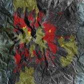
David McLelland, Auracle Remote Sensing’s president, added that the company will also contribute its 3-D Bare Rock Model that works to integrate radar and optical data collected by satellites to identify rock formations.
“The ability to look through land cover, rock or soils that are laying over a mineral deposit is a great advantage in geological mapping,” he said.
McLelland added that the partnership will see the combination of Auracle’s structural analysis with DigitalGlobe’s WorldView-3 satellite imagery.


